The Unique Maps Co.
Old Map of Wallace, Idaho by USGS, 1903 – Coeur d’Alene River, Burke & Murray
Old Map of Wallace, Idaho by USGS, 1903 – Coeur d’Alene River, Burke & Murray
Não foi possível carregar a disponibilidade de retirada.
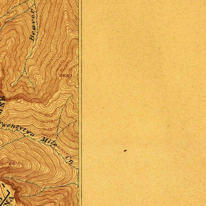
Published in 1903 by the United States Geological Survey, “Coeur D’Alene District” presents one of the American West’s most storied mining landscapes at a moment of intense industrial transformation. Centered on Wallace, Idaho, the map records the mountainous heart of the Coeur d’Alene mining region in a precise 1:62,500 topographical format. Its classification as a special map reflects the economic and geological importance of the district, where silver, lead, and zinc extraction had reshaped both settlement and transportation by the turn of the twentieth century. The map’s dense network of contours, drainage lines, and named creeks reveals a landscape in which human ambition pressed into steep valleys, forested slopes, and mineral-rich ridges.
The US Geological Survey, established in 1879, became one of the defining institutions of American scientific cartography, charged with measuring, classifying, and understanding the nation’s vast terrain. In regions such as northern Idaho, its work was not merely descriptive but practical: maps like this supported mining, rail construction, land management, and geological study. The Coeur d’Alene District was especially significant, having become one of the world’s great silver-producing areas after discoveries in the 1880s. By mapping Wallace, Burke, Murray, and surrounding valleys with such topographical precision, the USGS documented a frontier economy maturing into an industrial landscape, where geology dictated wealth and elevation governed access.
The design is classic early USGS topography, combining scientific restraint with striking visual depth. Contour lines and hachured relief give shape to the rugged mass of the Cabinet Mountains and the deeply incised valleys that cut through the district. The earthy palette emphasizes the severity of the terrain, making ridges, creek corridors, and settlement sites immediately legible. Wallace appears within a narrow mountain setting, an urban node hemmed in by steep slopes and mineralized ground. Nearby Burke, squeezed into Canyon Creek, evokes the extraordinary constraints of mining-town geography, where rail lines, mills, homes, and tunnels competed for every usable strip of valley floor.
Hydrology is central to the map’s power. The Coeur d’Alene River and its branching tributaries—Pine Creek, Canyon Creek, Big Creek, Quartz Creek, Dune Creek, and the Little North Fork—form the natural framework around which movement and industry developed. These waterways were routes, obstacles, power sources, and environmental conduits, binding the mining camps to the broader Clark Fork system. Features such as Emerald Lake and Little River add a quieter counterpoint to the industrial narrative, reminding the viewer that this was also a high mountain landscape of alpine basins, cold streams, and remote forested drainages. The map makes clear how water shaped both opportunity and vulnerability.
As a historical document, “Coeur D’Alene District” captures the region before later environmental regulation, highway modernization, and urban change altered its appearance and meaning. The early twentieth century was a period of prosperity but also labor conflict, ecological strain, and rapid infrastructural expansion in the Idaho panhandle. Gold Hill and other named mining localities speak to the feverish search for ore, while the pattern of towns and creeks reveals why settlement clustered in narrow corridors. Today, the map offers more than a record of elevation and place names: it is a portrait of a mineral frontier at full momentum, where geology, capital, water, and human endurance converged in one dramatic mountain district.
Cities, towns and places on this map
- Wallace, Idaho
- Murray, Idaho
- Coeur d'Alene River
- Cabinet Mountains
- Pine Creek
- Canyon Creek
- Burke, Idaho
- Big Creek
- Little North Fork
- Clark Fork River
- Quartz Creek
- Little River
- Gold Hill
- Dune Creek
- Emerald Lake
Historical context & cartographic details
- Published by the US Geological Survey in 1903.
- Historical 1:62,500 topographical map of the Coeur D'Alene District.
- Categorized as a special map.
- The US Geological Survey, established in 1879, played a major role in mapping and studying the landscapes, geology, and topography of the United States.
- Shows Wallace, Idaho and the surrounding area, a region historically associated with the late 19th-century mining boom.
- Features a traditional topographical style with elevation shown through hachures and contour lines.
- Uses an earthy color palette that emphasizes the mountainous terrain.
- Highlights the rugged Idaho landscape and terrain variations important for understanding transportation and settlement patterns.
- Captures an early 20th-century view of the region, showing both natural topography and the human influence of mining development.
- Reflects a landscape that has changed over time through environmental regulation and urban development.
Looking for a particular place? Review the detailed images to confirm that the town, landmark or feature you have in mind appears on the map. If you are unsure, ask our workshop to check before you order.
Detailed maps are especially rewarding at larger sizes, where names, boundaries and decorative features have more room to be appreciated. Use the close-up preview and size guide to choose the right scale for your wall.
This map looks amazing at sizes all the way up to 50in (125cm). If you are looking for a larger map, please get in touch.
The model in the listing images is holding the 36x24in (90x60cm) version of this map.
Where personalisation is available, you can add a short title or dedication, mark one meaningful place, or request one considered visual detail. See personalised map examples.
Every piece is printed to museum-grade archival standards using fade-resistant pigment inks on acid-free matte paper. Choose an unframed map print, framed map or canvas using the finish options above. Framed maps use crystal-clear optical acrylic and arrive ready to hang.
With its rich detail and strong sense of place, this map makes a considered gift for a new home, anniversary, retirement or anyone with a personal connection to the area shown. Still deciding? Explore our collection of rare old and vintage maps to discover another place, period or style.
Share