The Unique Maps Co.
Old Map of Scottsboro, Alabama by USGS, 1950 – Guntersville Reservoir & Tennessee Valley
Old Map of Scottsboro, Alabama by USGS, 1950 – Guntersville Reservoir & Tennessee Valley
Não foi possível carregar a disponibilidade de retirada.
Published in 1950 by the United States Geological Survey, “Scottsboro” presents a finely resolved topographic portrait of this northeastern Alabama community and its surrounding countryside. At the standard 1:24,000 scale, the map brings the terrain into intimate focus, balancing the growing urban fabric of Scottsboro with the agricultural lands, roads, hills, and valleys that shaped daily life in Jackson County. The title itself is modest, in the disciplined USGS manner, yet the sheet captures a place of layered significance: a town tied to rail and road networks, to the resources of the Tennessee Valley, and to the postwar transformation of the American South. Its contours and symbols create a precise visual record of a landscape poised between rural continuity and modern development.
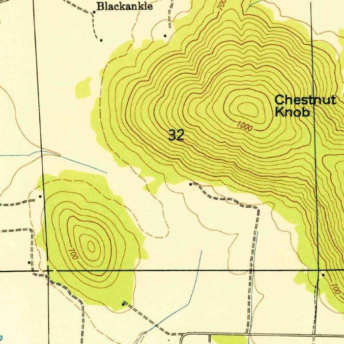
The cartographic language is unmistakably that of the USGS: clean, practical, and quietly elegant. Contour lines trace the rolling topography with disciplined regularity, allowing the eye to read ridges, slopes, drainage, and valley floors almost as a sculptural surface. Roads and highways knit together Scottsboro with its surrounding settlements and farms, while the color conventions distinguish built areas, vegetation, water, and cultivated land. This was mapping designed not for ornament but for authority—useful to engineers, planners, landowners, conservationists, and travelers alike. Yet its beauty lies precisely in that clarity. Every line serves a purpose, and together they form a richly detailed snapshot of mid-twentieth-century Alabama terrain.
Scottsboro occupies the heart of the sheet, shown as a populated center surrounded by rural land and natural relief. The town’s location helped define its character: close to the Tennessee River system, influenced by transportation corridors, and embedded within a landscape of hills, valleys, and productive farmland. By 1950, Scottsboro had already become nationally known for its place in American legal and civil rights history, while locally it remained a county seat shaped by commerce, agriculture, and access to natural resources. The map records the physical setting behind that history, showing how roads, terrain, and settlement patterns converged to create a regional hub in northeastern Alabama.
One of the most compelling presences on the map is the broader influence of the Tennessee Valley Authority and the Guntersville Reservoir system. Created as part of the New Deal’s ambitious program of flood control, navigation, electrification, and regional development, the TVA dramatically reshaped the Tennessee Valley during the twentieth century. Guntersville Reservoir, associated with the Tennessee River, altered water management, transportation, recreation, and land use across the region. On a map like this, the TVA’s imprint is not merely political or infrastructural; it is geographic. Water, roads, farms, and communities appear within a landscape increasingly organized by modern planning and public works.
As a historical document, this 1950 Scottsboro map captures a moment when American land management was becoming ever more scientific, systematic, and nationally coordinated. The USGS, long respected for its rigorous surveys, produced maps that became indispensable tools for understanding terrain and planning development. Here, the measured depiction of rolling hills, rural holdings, road alignments, and urban growth reflects broader postwar changes: expanding mobility, evolving agriculture, conservation awareness, and the reorganization of landscapes around infrastructure and public utilities. The result is more than a local map of Scottsboro; it is a carefully drawn record of a region in transition, where natural landforms and human ambition meet in precise topographic detail.
Cities, towns and places on this map
- Scottsboro
- Guntersville Reservoir
- Tennessee Valley Authority
- Various roads and highways crossing the area
- Contour lines indicating elevation changes
- Natural features including hills and valleys
- Surrounding rural areas and agricultural land
Historical context & cartographic details
- Produced by the United States Geological Survey (USGS)
- Historical 1:24,000 topographical map dated 1950
- Focuses on Scottsboro, Alabama, and its surrounding landscape
- Highlights urban development alongside nearby geographic features
- Uses a clear, organized layout typical of USGS topographic maps
- Contour lines illustrate elevation changes, landforms, and terrain relief
- Color palette indicates different land uses and vegetation types
- Shows rolling hills and valleys characteristic of the area
- Reflects changes in land use, urban development, and environmental conservation over time
- Represents broader trends in American land management and urbanization
Looking for a particular place? Review the detailed images to confirm that the town, landmark or feature you have in mind appears on the map. If you are unsure, ask our workshop to check before you order.
Detailed maps are especially rewarding at larger sizes, where names, boundaries and decorative features have more room to be appreciated. Use the close-up preview and size guide to choose the right scale for your wall.
This map looks amazing at sizes all the way up to 50in (125cm). If you are looking for a larger map, please get in touch.
The model in the listing images is holding the 16x20in (40x50cm) version of this map.
Where personalisation is available, you can add a short title or dedication, mark one meaningful place, or request one considered visual detail. See personalised map examples.
Every piece is printed to museum-grade archival standards using fade-resistant pigment inks on acid-free matte paper. Choose an unframed map print, framed map or canvas using the finish options above. Framed maps use crystal-clear optical acrylic and arrive ready to hang.
With its rich detail and strong sense of place, this map makes a considered gift for a new home, anniversary, retirement or anyone with a personal connection to the area shown. Still deciding? Explore our collection of rare old and vintage maps to discover another place, period or style.
Share