The Unique Maps Co.
Old Map of Guntersville, Alabama by USGS, 1948 – Guntersville Lake & Tennessee River
Old Map of Guntersville, Alabama by USGS, 1948 – Guntersville Lake & Tennessee River
Não foi possível carregar a disponibilidade de retirada.
Published in 1972 from 1948 survey work, “Guntersville” is a finely detailed US Geological Survey topographic map of one of northern Alabama’s most evocative river landscapes. Produced with support from the Tennessee Valley Authority, it captures Guntersville and its surrounding country at the precise 1:24,000 scale, where roads, railways, contours, watercourses, and settlement patterns become distinctly legible. The map centers on Guntersville Lake and the Tennessee River, presenting a region shaped by water, engineering, and upland terrain. Its mid-20th-century perspective is especially compelling: it records a landscape already transformed by TVA-era river management, yet still closely tied to older patterns of town, farm, woodland, and valley.
The US Geological Survey brought to this map the disciplined clarity for which its quadrangles became indispensable to planners, geologists, hikers, engineers, and local historians. Founded in the late 19th century, the USGS developed a cartographic language that balanced scientific precision with remarkable visual elegance: contour lines translate relief into readable form, color differentiates land and water, and symbols mark roads, railways, buildings, forests, and public spaces with quiet authority. In “Guntersville,” that system allows the viewer to understand both the broad structure and intimate detail of the terrain. Hills, valleys, lake margins, and transport corridors are rendered not as decoration, but as a sophisticated portrait of place.
Guntersville Lake dominates the composition, its blue expanse tracing the course of the Tennessee River through Marshall County’s rolling landscape. Created as part of the Tennessee Valley Authority’s ambitious program of flood control, navigation, hydroelectric power, and regional development, the lake became one of Alabama’s defining recreational waters. The map shows the intimate relationship between the town of Guntersville and the shoreline, a setting that helped establish the area’s reputation for fishing, boating, and scenic leisure. Roads approach the water, wooded areas press toward the coves, and the surrounding elevations frame the lake as both a natural spectacle and a modern managed resource.
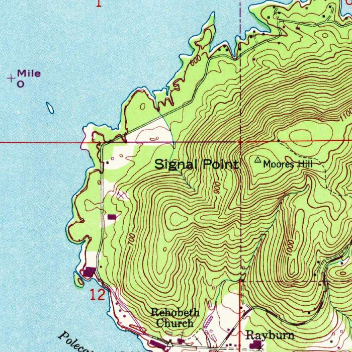
The topographic character of the map is among its greatest pleasures. Fine contour lines articulate the rise and fall of the land around Guntersville, revealing hills, hollows, and valleys that might be softened or invisible on a simpler road map. This is a terrain made for close reading: ridgelines emerge through the spacing of contours, lowlands gather near the lake and river, and routes can be understood in relation to slope and elevation. Parks, forested tracts, highways, local roads, and railways are woven into this relief, making the map useful not only for navigation but for imagining movement through the landscape—on foot, by car, by rail, or across the water.
As a historical document, the 1972 publication preserves a valuable moment in the evolution of Guntersville and the wider Tennessee Valley. It reflects the geographical understanding and land-use patterns of the postwar decades, when recreation, infrastructure, and urban development increasingly shaped communities around TVA reservoirs. The map’s vivid contrast between water and land, supported by its careful contouring, gives it an immediacy that remains engaging today. For collectors of Alabama, Tennessee River, or USGS cartography, “Guntersville” offers more than geographic information: it is a refined record of a lakeside city and its surrounding hills at a pivotal stage in their modern history.
Cities, towns and places on this map
- Guntersville
- Guntersville Lake
- Tennessee River
- Highways and local roads
- Railways
- Parks
- Forested areas
- Nearby hills and valleys
Historical context & cartographic details
- Produced by the US Geological Survey, with support from the Tennessee Valley Authority
- Created in 1948 and published in 1972
- Historical 1:24,000 topographical map of Guntersville, Alabama and the surrounding area
- The US Geological Survey is known for detailed cartographic work supporting fields such as ecology, geology, and urban planning
- Uses vibrant color coding to distinguish elevation changes and water bodies
- Features contour lines showing terrain elevation and topographic detail
- Shows hills, valleys, roads, railways, parks, and forested areas with clear geographic detail
- The 1972 publication provides a mid-20th-century snapshot of the area’s development, land use, and geographical understanding
- Contrasting colors between land and water enhance legibility and practical use for recreation, planning, and outdoor activities
Looking for a particular place? Review the detailed images to confirm that the town, landmark or feature you have in mind appears on the map. If you are unsure, ask our workshop to check before you order.
Detailed maps are especially rewarding at larger sizes, where names, boundaries and decorative features have more room to be appreciated. Use the close-up preview and size guide to choose the right scale for your wall.
This map looks amazing at sizes all the way up to 50in (125cm). If you are looking for a larger map, please get in touch.
The model in the listing images is holding the 16x20in (40x50cm) version of this map.
Where personalisation is available, you can add a short title or dedication, mark one meaningful place, or request one considered visual detail. See personalised map examples.
Every piece is printed to museum-grade archival standards using fade-resistant pigment inks on acid-free matte paper. Choose an unframed map print, framed map or canvas using the finish options above. Framed maps use crystal-clear optical acrylic and arrive ready to hang.
With its rich detail and strong sense of place, this map makes a considered gift for a new home, anniversary, retirement or anyone with a personal connection to the area shown. Still deciding? Explore our collection of rare old and vintage maps to discover another place, period or style.
Share