The Unique Maps Co.
Old Map of Graeagle, California by USGS, 1972 – Blairsden & Plumas National Forest
Old Map of Graeagle, California by USGS, 1972 – Blairsden & Plumas National Forest
Não foi possível carregar a disponibilidade de retirada.
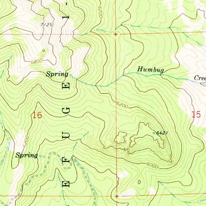
Published in 1974 from 1972 mapping, the U.S. Geological Survey’s “Blairsden” quadrangle presents a finely detailed portrait of the northern Sierra Nevada around Graeagle and Blairsden, California. Drawn at the classic 1:24,000 scale, it belongs to the USGS’s celebrated series of topographic maps, prized for their exacting depiction of terrain, settlement, waterways, roads, and forest boundaries. Here, the landscape is rendered through closely worked contour lines that reveal the folded character of Plumas County: ridges rising above narrow valleys, drainage courses threading through wooded slopes, and small lake features set among mountain basins. As a snapshot of the early 1970s, the map captures a region balanced between working mountain communities, forest management, and expanding recreation.
The map centers on Graeagle and Blairsden, two small communities whose histories are closely tied to the timber economy and mountain travel corridors of the Sierra Nevada. Graeagle, now known for its alpine setting, golf, fishing, hiking, and access to surrounding forests, appears within a terrain of gentle valley floors and rising slopes, its roads and settlement pattern carefully fixed by the surveyors’ hand. Blairsden, nearby, occupies a similarly strategic position amid routes crossing the high country. The cartography quietly records how these communities sit within a broader natural amphitheater: not isolated dots, but settlements shaped by ridgelines, streams, meadows, and the practical necessities of movement through mountainous ground.
One of the map’s great pleasures is its portrayal of relief. The USGS contour system translates the land into a precise visual language, allowing the viewer to read elevation, slope, and landform almost intuitively. Tight contour intervals indicate steeper hillsides and rugged rises, while wider spacing suggests valley bottoms, benches, and gentler approaches. Unnamed peaks and valleys become legible through this elegant geometry, giving the map both scientific authority and aesthetic rhythm. The surrounding topography suggests a landscape of forested ridges, drainage divides, and sheltered basins, with roads and possible trails threading through the terrain in response to the underlying shape of the land.
Plumas National Forest forms an essential part of the map’s historical and geographical setting. Established in the early twentieth century, the forest encompasses a vast portion of the northern Sierra, where timber, watershed protection, grazing, mining legacies, and recreation have long overlapped. On this quadrangle, forest lands frame the communities and help define the character of the region, emphasizing the close relationship between human settlement and public mountain landscapes. The presence of lakes, valleys, and wooded uplands points to the recreational appeal that would become increasingly important in the decades after the map’s publication, as visitors sought fishing waters, campgrounds, trails, and scenic routes through the high country.
As a document of the early 1970s, “Blairsden” offers more than geographic information; it preserves a moment in the evolving history of a Sierra Nevada community landscape. Roads, developed areas, forest boundaries, and topographic details together reveal patterns of access and land use before later waves of growth, conservation planning, and recreational development further transformed the region. The map’s restrained USGS design—clear lettering, measured contours, carefully differentiated symbols—gives it an enduring authority. It invites both practical reading and historical reflection, showing Graeagle, Blairsden, and their surrounding mountains as they were understood by federal surveyors: a finely measured terrain of valleys, ridges, water, forest, and settlement.
Cities, towns and places on this map
- Graeagle
- Blairsden
- Plumas National Forest
- Various unnamed peaks and valleys
- Lake features, specific names not discernible
- Possible trails or roads connecting the areas
- Contours illustrating elevation changes across the terrain
Historical context & cartographic details
- Name of the map: Blairsden
- Produced and published by the U.S. Geological Survey (USGS)
- Historical 1:24,000 topographical map of Graeagle, California, and the surrounding area
- Dated 1972 with a 1974 imprint
- Uses contour lines to represent elevations, landforms, and topographic variation
- Shows hilly terrain with valleys, changing elevations, and potential lake features
- Serves as an early 1970s snapshot of the area, reflecting historical development and land-use patterns
Looking for a particular place? Review the detailed images to confirm that the town, landmark or feature you have in mind appears on the map. If you are unsure, ask our workshop to check before you order.
Detailed maps are especially rewarding at larger sizes, where names, boundaries and decorative features have more room to be appreciated. Use the close-up preview and size guide to choose the right scale for your wall.
This map looks amazing at sizes all the way up to 50in (125cm). If you are looking for a larger map, please get in touch.
The model in the listing images is holding the 16x20in (40x50cm) version of this map.
Where personalisation is available, you can add a short title or dedication, mark one meaningful place, or request one considered visual detail. See personalised map examples.
Every piece is printed to museum-grade archival standards using fade-resistant pigment inks on acid-free matte paper. Choose an unframed map print, framed map or canvas using the finish options above. Framed maps use crystal-clear optical acrylic and arrive ready to hang.
With its rich detail and strong sense of place, this map makes a considered gift for a new home, anniversary, retirement or anyone with a personal connection to the area shown. Still deciding? Explore our collection of rare old and vintage maps to discover another place, period or style.
Share