The Unique Maps Co.
Old Map of Del Mar, California by USGS, 1953 – San Diego, Solana Beach & Pacific Ocean
Old Map of Del Mar, California by USGS, 1953 – San Diego, Solana Beach & Pacific Ocean
Não foi possível carregar a disponibilidade de retirada.
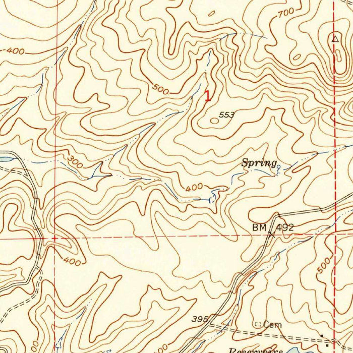
Titled simply “Del Mar,” this United States Geological Survey 1:24,000 topographical map presents the northern San Diego coast with the clarity and restraint that made USGS quadrangles indispensable to planners, engineers, hikers, and historians. Dated 1953 and carrying a 1959 imprint, it captures Del Mar and its surrounding landscape at a pivotal moment, when Southern California’s coastal communities were beginning to feel the full force of postwar suburban expansion. The Pacific Ocean forms the map’s western edge, while roads, neighborhoods, agricultural parcels, and open land trace the evolving relationship between settlement and terrain. Del Mar appears not merely as a seaside town, but as a node in a wider coastal geography of lagoons, river valleys, bluffs, and inland routes.
The map’s appeal lies in its precise topographic language: contour lines articulate the rise from coastal flats to hills and mesas, revealing a landscape far more varied than a simple beach resort image suggests. Around Del Mar, the land steps inland from oceanfront bluffs and low-lying coastal areas toward rolling terrain cut by drainage channels and ravines. The San Dieguito River and Penasquitos Lagoon are especially significant features, anchoring the map’s hydrological structure and reminding the viewer that this stretch of coast is shaped as much by wetlands and river mouths as by surf and sand. Subtle color distinctions identify developed areas, cultivated land, and natural spaces, giving the sheet both technical authority and visual elegance.
Del Mar itself is shown during a fascinating chapter in its history. Known today for its beaches, village atmosphere, and famous racetrack, the community in the early 1950s remained comparatively small, poised between resort town, agricultural hinterland, and emerging suburb. The map records residential neighborhoods and structures, but also surrounding open land and agricultural use, offering a glimpse of a coastline not yet fully absorbed into the metropolitan fabric of San Diego. Nearby Solana Beach and the coastal settlements to the north and south appear within the same regional rhythm: small communities linked by roads, rail or highway corridors, and the shared draw of the Pacific shore.
Produced by the United States Geological Survey, the map belongs to one of the most important cartographic traditions in American history. USGS topographic mapping was designed for accuracy, consistency, and utility, but its best sheets also possess a quiet beauty born of disciplined observation. Every contour, road, watercourse, and boundary contributes to a layered portrait of place. In the Del Mar quadrangle, that portrait is especially evocative because the terrain itself is so dynamic: beaches give way to lagoons, river valleys, coastal hills, and inland routes connecting the region to greater San Diego. Trails, paths, highways, and local roads together reveal how people moved through a landscape still negotiating between rural openness and urban growth.
As a historical document, “Del Mar” offers an absorbing view of Southern California before the most dramatic phases of late twentieth-century development transformed the coast. The roads and highways shown, including the corridors associated with what would become the region’s modern freeway network, hint at the coming acceleration of suburbanization. Yet the map still preserves a world of agricultural land, open spaces, wetlands, and relatively discrete communities. For collectors, historians, and admirers of California’s coastal geography, it is a compelling record of transition: Del Mar before its contemporary density, San Diego’s northern coast before full metropolitan integration, and a landscape whose natural features remained vividly legible beneath the expanding pattern of human settlement.
Cities, towns and places on this map
- Del Mar
- San Diego
- Solana Beach
- San Dieguito River
- Pacific Ocean
- Penasquitos Lagoon
- Coastal areas near Del Mar
- Roads and highways, including Interstate 5
- Trails and paths in surrounding areas
- Nearby parks and open spaces
- Agricultural land
- Residential neighborhoods and structures
Historical context & cartographic details
- Historical 1:24,000 topographical map produced by the United States Geological Survey.
- Dated 1953 with a 1959 imprint.
- Shows Del Mar, California, and the surrounding coastal area.
- Created by the United States Geological Survey, known for detailed and accurate mapping of the United States.
- Uses contour lines to show elevation changes across the landscape.
- Includes color distinctions for urban areas, farmland, and natural landscapes.
- Depicts coastal plains, hills, and varied terrain through topographic detail and shading.
- Reflects the area during a period of significant post-World War II suburban growth.
- Offers a useful historical comparison point for changes in land use, urban expansion, and environmental preservation.
Looking for a particular place? Review the detailed images to confirm that the town, landmark or feature you have in mind appears on the map. If you are unsure, ask our workshop to check before you order.
Detailed maps are especially rewarding at larger sizes, where names, boundaries and decorative features have more room to be appreciated. Use the close-up preview and size guide to choose the right scale for your wall.
This map looks amazing at sizes all the way up to 50in (125cm). If you are looking for a larger map, please get in touch.
The model in the listing images is holding the 16x16in (40x40cm) version of this map.
Where personalisation is available, you can add a short title or dedication, mark one meaningful place, or request one considered visual detail. See personalised map examples.
Every piece is printed to museum-grade archival standards using fade-resistant pigment inks on acid-free matte paper. Choose an unframed map print, framed map or canvas using the finish options above. Framed maps use crystal-clear optical acrylic and arrive ready to hang.
With its rich detail and strong sense of place, this map makes a considered gift for a new home, anniversary, retirement or anyone with a personal connection to the area shown. Still deciding? Explore our collection of rare old and vintage maps to discover another place, period or style.
Share