The Unique Maps Co.
Old Map of Cornville, Arizona by USGS, 1968 – Prescott National Forest, Oak Creek & Verde Valley
Old Map of Cornville, Arizona by USGS, 1968 – Prescott National Forest, Oak Creek & Verde Valley
Não foi possível carregar a disponibilidade de retirada.
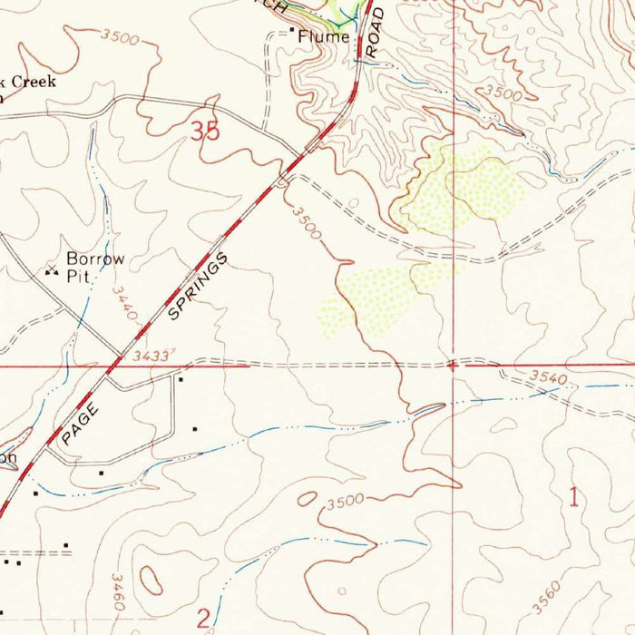
Published in 1971 from survey work completed in 1968, the US Geological Survey’s “Cornville” presents a finely resolved topographic portrait of central Arizona’s Verde Valley country. At a scale of 1:24,000, it captures Cornville not as an isolated settlement, but as part of a broader landscape of washes, ridges, valleys, roads, cultivated parcels, and watercourses. The map’s title is spare, in the classic USGS manner, yet the sheet is richly descriptive: contour lines gather and loosen across the page, revealing the rise and fall of terrain around the community. It is a precise historical record of place, showing Cornville and its surrounding country at a moment before later decades of growth reshaped parts of the region.
The United States Geological Survey brought to this map the disciplined visual language that made its quadrangles indispensable to engineers, planners, geologists, hikers, and land managers. Every contour, symbol, and line weight serves a purpose, turning the apparent complexity of Arizona terrain into a readable geographic system. Roads, drainage channels, structures, boundaries, and elevation are organized with understated clarity, allowing the viewer to understand both human settlement and natural form at once. The 1:24,000 scale is especially intimate, fine enough to show local detail while still encompassing the broader geographic relationships around Cornville. This is cartography in its most functional and elegant form: empirical, restrained, and quietly beautiful.
Cornville lies in a landscape shaped by water, elevation, and arid-country drainage. The map emphasizes hydrography and terrain, recording the rivers, valleys, washes, and intermittent channels that define movement through this part of Arizona. In the Verde Valley region, watercourses such as Oak Creek and nearby tributary systems have long influenced settlement, agriculture, travel routes, and ecological richness. The contouring reveals the subtle drama of the land: low valley floors, rising slopes, dissected hillsides, and the channels that carry seasonal runoff. These features are not decorative additions, but the essential anatomy of the place, showing how Cornville’s community developed in relation to the physical geography surrounding it.
Beyond Cornville itself, the sheet evokes the wider upland and forested setting associated with Yavapai County and the Prescott National Forest region. Prescott, an important historic center to the southwest, anchors the broader regional context, while the surrounding highlands and valleys speak to the transition between central Arizona’s basin landscapes and more elevated forest country. The map’s dense contour work conveys this varied topographic character with remarkable economy: ridges, draws, saddles, and valley margins emerge through measured brown lines. Such details would have been vital for anyone navigating, surveying, building, ranching, or managing land in an area where topography governs access, water, and use.
As a historical document, “Cornville” preserves the geography of the area as recorded in 1968, offering a snapshot of landscape, infrastructure, and hydrological features before subsequent development and environmental change. USGS topographic maps often acquire their significance gradually: what was made as practical geographic information becomes, over time, a layered record of roads since altered, land uses transformed, and settlements expanded. This sheet invites comparison between past and present, revealing how much of the terrain endures even as human patterns shift. Its appeal lies in that duality—scientific precision paired with historical atmosphere, a measured depiction of Cornville and its surrounding Arizona landscape at a particular, recoverable moment in time.
Cities, towns and places on this map
- Cornville, Arizona
- Prescott, Arizona
- Areas within the Prescott National Forest
- Rivers and valleys surrounding Cornville
- Landmarks and terrain features indicated by contour lines
Historical context & cartographic details
- Produced by the US Geological Survey (USGS)
- Originally created in 1968 and published in 1971
- Scale: 1:24,000
- Historical topographical map showing Cornville, Arizona, and the surrounding region
- Incorporates 1968 survey data, with emphasis on hydrography and terrain features
- Uses contour lines to represent elevation changes
- Includes USGS-style symbols for land uses and geographic features
- Shows varied regional topography, including hills and valleys
- Provides a snapshot of the area’s geographic and hydrological features as recorded in 1968
- Useful for understanding landscape changes over time, including development or environmental alterations
Looking for a particular place? Review the detailed images to confirm that the town, landmark or feature you have in mind appears on the map. If you are unsure, ask our workshop to check before you order.
Detailed maps are especially rewarding at larger sizes, where names, boundaries and decorative features have more room to be appreciated. Use the close-up preview and size guide to choose the right scale for your wall.
This map looks amazing at sizes all the way up to 50in (125cm). If you are looking for a larger map, please get in touch.
The model in the listing images is holding the 16x20in (40x50cm) version of this map.
Where personalisation is available, you can add a short title or dedication, mark one meaningful place, or request one considered visual detail. See personalised map examples.
Every piece is printed to museum-grade archival standards using fade-resistant pigment inks on acid-free matte paper. Choose an unframed map print, framed map or canvas using the finish options above. Framed maps use crystal-clear optical acrylic and arrive ready to hang.
With its rich detail and strong sense of place, this map makes a considered gift for a new home, anniversary, retirement or anyone with a personal connection to the area shown. Still deciding? Explore our collection of rare old and vintage maps to discover another place, period or style.
Share