The Unique Maps Co.
Old Map of Chiricahua National Monument, Arizona by USGS, 1979 – Cochise Head & Coronado National Forest
Old Map of Chiricahua National Monument, Arizona by USGS, 1979 – Cochise Head & Coronado National Forest
Não foi possível carregar a disponibilidade de retirada.
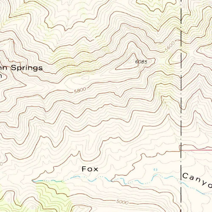
Published in 1983 from mapping completed in 1979, the USGS quadrangle titled “Cochise Head” presents a richly detailed portrait of southeastern Arizona’s Chiricahua country. At 1:24,000 scale, it captures the dramatic terrain around Chiricahua National Monument, where mountains, canyons, forest, and desert margins converge in one of the Southwest’s most distinctive landscapes. The map’s disciplined topographic language—closely spaced contour lines, shaded relief, and carefully placed feature names—gives immediate form to the rugged elevations and broken ridgelines. Greens and browns distinguish vegetation and terrain character, while roads, drainages, and landmarks establish a precise geographic framework for a region celebrated for its geology, ecological diversity, and remote grandeur.
The United States Geological Survey brought to this map the clarity and authority that made its topographic quadrangles indispensable to scientists, land managers, hikers, engineers, and conservationists. Founded in the nineteenth century to classify and understand the nation’s lands and resources, the USGS developed a cartographic style that balances technical precision with remarkable visual elegance. In “Cochise Head,” that tradition is evident in the fine contour intervals tracing slopes, saddles, washes, and canyon walls. Rather than presenting the landscape as a simple scenic backdrop, the map reveals it as a system of elevation, drainage, access, and protected land—an exacting survey of a place where geology and land use are inseparable.
At the heart of the sheet is the country around Chiricahua National Monument, famous for its extraordinary rock pinnacles, hoodoos, balanced formations, and volcanic tuff sculpted by time into a surreal stone forest. Bonito Canyon and nearby drainages cut through this terrain, helping define the monument’s secluded character and biological variety. The wider map reaches into the Coronado National Forest, where higher elevations support oak, pine, and mixed woodland habitats distinct from the surrounding desert basins. This is a landscape of vertical transition: contours climb from canyon floors toward ridges and peaks, illustrating why the Chiricahuas have long been known as one of Arizona’s great “sky island” mountain ranges.
Beyond the monument, the map situates Cochise Head within a larger network of evocative Arizona places: Rustler Canyon, Skull Canyon, Indian Hollow, Cima Canyon, Sanchez Canyon, Pasco Canyon, and Rucker Canyon, each name suggesting a layered frontier and natural history. The Dos Cabezas Mountains and Ash Peak contribute to the sense of a region shaped by volcanic activity, erosion, and long human passage. Roads such as High Lonesome Road, Cave Creek Road, National Forest Road 42, and State Route 80 mark the sparse corridors by which travelers, ranchers, researchers, and visitors navigate this remote terrain. The inclusion of Willcox Playa gestures toward the broad desert basins lying beyond the mountain mass.
Historically, “Cochise Head” belongs to an era when America’s public lands were being mapped with renewed attention to conservation, recreation, and ecological stewardship. By the late 1970s and early 1980s, detailed federal mapping served not only practical navigation but also the management of national monuments, forests, habitats, watersheds, and access routes. In this sense, the map is both a scientific document and a snapshot of land-use priorities at a particular moment. It records the Chiricahua region before subsequent decades of changing visitation, preservation policy, fire management, and ecological study. Its contours preserve the enduring architecture of mountains and canyons, while its labels preserve the cultural geography of southeastern Arizona.
Cities, towns and places on this map
- Chiricahua National Monument
- Coronado National Forest
- Bonito Canyon
- Rustler Canyon
- Ash Peak
- Dos Cabezas Mountains
- Skull Canyon
- Indian Hollow
- Cima Canyon
- Fort Grant
- Rucker Canyon
- Chiricahua Peak
- Carr Peak
- Sanchez Canyon
- Pasco Canyon
- Willcox Playa
- High Lonesome Road
- Cave Creek Road
- National Forest Road 42
- State Route 80
Historical context & cartographic details
- Produced by the United States Geological Survey as a historical 1:24,000 topographical map.
- Mapped in 1979 and published with a 1983 imprint.
- Shows Chiricahua National Monument in Arizona and the surrounding area.
- Features contour lines to show elevation changes and shaded relief to illustrate topography.
- Includes labels for geographic features, roads, and notable landmarks.
- Uses greens and browns to represent different elevations and terrain types.
- Depicts diverse terrain, including mountains, canyons, and forested areas.
- Reflects a period when natural areas were being mapped for conservation, recreation, land management, and scientific research.
Looking for a particular place? Review the detailed images to confirm that the town, landmark or feature you have in mind appears on the map. If you are unsure, ask our workshop to check before you order.
Detailed maps are especially rewarding at larger sizes, where names, boundaries and decorative features have more room to be appreciated. Use the close-up preview and size guide to choose the right scale for your wall.
This map looks amazing at sizes all the way up to 50in (125cm). If you are looking for a larger map, please get in touch.
The model in the listing images is holding the 16x20in (40x50cm) version of this map.
Where personalisation is available, you can add a short title or dedication, mark one meaningful place, or request one considered visual detail. See personalised map examples.
Every piece is printed to museum-grade archival standards using fade-resistant pigment inks on acid-free matte paper. Choose an unframed map print, framed map or canvas using the finish options above. Framed maps use crystal-clear optical acrylic and arrive ready to hang.
With its rich detail and strong sense of place, this map makes a considered gift for a new home, anniversary, retirement or anyone with a personal connection to the area shown. Still deciding? Explore our collection of rare old and vintage maps to discover another place, period or style.
Share