The Unique Maps Co.
Old Map of Bodega Bay, California by USGS, 1944 – Bodega Head & Sonoma Coast
Old Map of Bodega Bay, California by USGS, 1944 – Bodega Head & Sonoma Coast
Não foi possível carregar a disponibilidade de retirada.
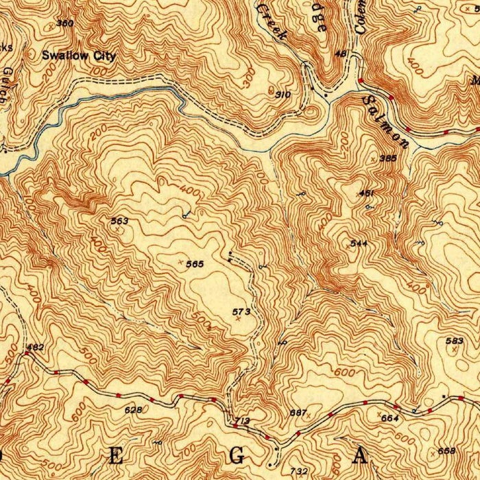
Published in 1944, the US Geological Survey’s “Bodega Head” presents a precise mid-century portrait of one of Northern California’s most evocative coastal landscapes. At a scale of 1:31,680, the map brings Bodega Bay, Bodega Harbor, Doran Beach, and the rugged promontory of Bodega Head into close topographic focus. Its official cartouche and disciplined graphic language speak to the authority of federal survey work, while the landscape itself remains wonderfully dramatic: ocean, harbor, cliff, dune, and hillside compressed into a single coastal sheet. This is California before the full force of later development, a record of shorelines, roads, coves, and contours at a moment when the region retained much of its quiet, windswept character.
The US Geological Survey, established in 1879, became the nation’s great cartographic institution, tasked with measuring, classifying, and mapping the American landscape. In this map, that scientific mission is expressed through the elegant clarity of traditional topography: contour lines in warm brown trace the rise and fall of the land, while green tones distinguish vegetated or lowland areas. Around Bodega Head, these contours become especially expressive, revealing steep coastal slopes and the sculptural form of the headland as it meets the Pacific Ocean. The map is not merely a navigational document; it is a study in landform, showing how geology, erosion, and exposure have shaped a coast known for its beauty and severity.
Bodega Bay dominates the composition as both natural harbor and maritime threshold, opening westward to the Pacific while sheltered by the curving mass of Bodega Head. The presence of Bodega Harbor, Horseshoe Cove, and nearby secluded coves emphasizes the intricate relationship between land and water along this part of the Sonoma Coast. Doran Beach appears as a slender coastal feature separating calmer harbor waters from the open ocean, a reminder of the shifting sands and tidal dynamics that define the area. State Highway 1 threads through the coastal terrain, already marking the route that would become one of America’s most celebrated scenic drives, connecting small settlements, working shores, and wild headlands.
Beyond its immediate coastal drama, the map evokes a broader Northern California geography of creeks, points, and ocean-facing promontories. Tomales Point lies to the south across the maritime landscape, while Salmon Creek and other waterways suggest the inland drainage systems that descend toward the sea. References to Austin Creek and Cottoneva Creek place the sheet within a wider hydrological world of ridges, forests, and coastal watersheds. The Pacific Ocean is rendered not as an empty expanse, but as an active cartographic presence, with open water areas framing the land and defining its edge. Even distant names such as Cape Mendocino summon the long, restless sweep of the California coast.
As a historical document, “Bodega Head” captures the Sonoma shoreline before the environmental consciousness and conservation battles that later shaped public understanding of the region. Much of the surrounding coast is now associated with protected landscapes such as Sonoma Coast State Park, but this 1944 map records the terrain in an earlier phase, when its coves, beaches, roads, and hills were being systematically documented for practical and governmental purposes. The result is both utilitarian and atmospheric: a map of exact measurements that also conveys the solitude of cliffs, surf, and windswept grassland. For collectors, it offers a compelling glimpse of Bodega Bay’s mid-20th-century geography, rendered with the sober beauty of classic USGS cartography.
Cities, towns and places on this map
- Bodega Bay
- Bodega Head
- Tomales Point
- Horseshoe Cove
- Doran Beach
- Bodega Harbor
- State Highway 1
- Pacific Ocean
- Cape Mendocino
- Salmon Creek
- Austin Creek
- Cottoneva Creek
- Sonoma Coast State Park
- Open water areas depicted in the Pacific Ocean
- Secluded cove noted near Bodega Head
Historical context & cartographic details
- Historical topographical map titled “Bodega Head”, dated 1944.
- Produced by the US Geological Survey (USGS), a scientific agency of the U.S. federal government known for mapping and surveying land.
- Drawn at a scale of 1:31,680.
- Uses a traditional topographic style, with contour lines showing elevation changes.
- Terrain and land cover are represented in varying shades of brown and green.
- Includes a prominent cartouche with official markings, emphasizing its government survey origin.
- Shows detailed coastal terrain, including hills, cliffs, and elevation changes.
- Captures the area in the mid-20th century, before later development and environmental changes.
Looking for a particular place? Review the detailed images to confirm that the town, landmark or feature you have in mind appears on the map. If you are unsure, ask our workshop to check before you order.
Detailed maps are especially rewarding at larger sizes, where names, boundaries and decorative features have more room to be appreciated. Use the close-up preview and size guide to choose the right scale for your wall.
This map looks amazing at sizes all the way up to 50in (125cm). If you are looking for a larger map, please get in touch.
The model in the listing images is holding the 16x20in (40x50cm) version of this map.
Where personalisation is available, you can add a short title or dedication, mark one meaningful place, or request one considered visual detail. See personalised map examples.
Every piece is printed to museum-grade archival standards using fade-resistant pigment inks on acid-free matte paper. Choose an unframed map print, framed map or canvas using the finish options above. Framed maps use crystal-clear optical acrylic and arrive ready to hang.
With its rich detail and strong sense of place, this map makes a considered gift for a new home, anniversary, retirement or anyone with a personal connection to the area shown. Still deciding? Explore our collection of rare old and vintage maps to discover another place, period or style.
Share