The Unique Maps Co.
Map of Storrs, Connecticut by USGS, 1994 – Hartford, Mansfield & Connecticut River
Map of Storrs, Connecticut by USGS, 1994 – Hartford, Mansfield & Connecticut River
Não foi possível carregar a disponibilidade de retirada.
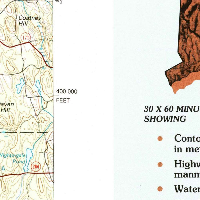
Titled “Hartford,” this United States Geological Survey map was created in 1994 and issued with a 1995 imprint, capturing central and northeastern Connecticut at a moment of late twentieth-century transition. At 1:100,000 scale, it presents a broad yet disciplined portrait of the region, from the capital city of Hartford and its dense metropolitan ring to the quieter academic and rural landscapes around Storrs and Mansfield. The USGS’s characteristic clarity gives the map both scientific authority and visual poise: roads, rivers, settlements, elevations, and wooded uplands are organized into a precise cartographic language. It is a map of infrastructure and terrain in balance, showing Connecticut not simply as a network of towns, but as a shaped landscape of valleys, ridges, reservoirs, and corridors.
The mapmaker, the United States Geological Survey, occupies a distinguished place in American cartography. Founded in the nineteenth century to classify and understand the nation’s lands and resources, the USGS became synonymous with exacting topographical mapping. In “Hartford,” that tradition is evident in the careful rendering of relief, hydrography, transportation routes, and settlement patterns. The design is functional, but never austere: subtle elevation tints and contour information bring out the undulations of Connecticut’s terrain, while the hierarchy of highways, local roads, railways, and trails reveals how movement across the region was structured. This is the kind of map made for practical use, yet it also offers the quiet pleasure of a landscape interpreted with scholarly precision.
Hartford anchors the western portion of the map, with East Hartford, West Hartford, South Windsor, Glastonbury, Vernon, and Enfield forming part of the wider metropolitan fabric. The Connecticut River, one of New England’s great defining waterways, lends structure and historical depth to the scene, tracing a corridor long associated with Indigenous routes, colonial settlement, agriculture, industry, and transportation. Bridges, roads, and rail lines show how the river valley became a spine of commerce and urban growth. Yet the map also shows the city’s proximity to open ground: reservoirs, parks, wooded tracts, and rolling uplands appear surprisingly close to the urban core, underscoring the compact geography of Connecticut, where dense settlement and rural quiet often exist within a few miles of one another.
To the east, the map opens toward Storrs, Mansfield, Willimantic, Coventry, Andover, Bolton, Tolland, Stafford, and Lebanon, a region of university life, mill-town history, farmland, forest, and glacially shaped waters. Storrs is especially notable as the home of the University of Connecticut, whose presence helped define the cultural and economic character of the surrounding communities by the 1990s. Willimantic, with its industrial heritage along the Willimantic River, adds another layer of historical resonance, recalling the textile and manufacturing era that shaped many New England towns. Lakes, reservoirs, and smaller river systems punctuate the map, while the road network reveals the gradual knitting together of once-distinct villages, academic centers, commuter towns, and rural districts.
As a historical document, “Hartford” preserves Connecticut at a revealing point in its modern development. The mid-1990s were a period of expanding suburbanization, evolving transportation patterns, and changing land use, and the map records the region before later decades of growth further altered the edges of towns, campuses, and commercial corridors. Major highways and local roads indicate the pull of Hartford as a capital and employment center, while the distribution of parks, reservoirs, and forests reflects enduring efforts to protect water supplies and recreational landscapes. Its appeal lies in this layered perspective: a technically rigorous topographical map that also reads as a portrait of place, showing the capital region and northeastern Connecticut in a poised interval between historic settlement patterns and contemporary transformation.
Cities, towns and places on this map
- Hartford
- Storrs
- Mansfield
- Willimantic
- East Hartford
- South Windsor
- West Hartford
- Glastonbury
- Vernon
- Tolland
- Enfield
- Coventry
- Andover
- Bolton
- Lebanon
- Stafford
- Reservoirs
- Parks
- Lakes
- Rivers, including parts of the Connecticut River
- Major highways and roads
- Railways
- Trails
- Landmarks
Historical context & cartographic details
- Produced by the United States Geological Survey, or USGS.
- Historical 1:100,000 topographical map dated 1994, with a 1995 imprint.
- Shows geographic and infrastructural development in Connecticut during the mid-1990s.
- Uses the clear, functional design typical of USGS topographical maps.
- Emphasizes elevation changes, transportation routes, and water bodies.
- Shading is used to represent different elevation levels.
- Depicts a mix of urban areas and natural landscapes, including hills, forests, and waterways.
- Reflects a landscape that may have since changed through urban expansion and shifts in land use.
Looking for a particular place? Review the detailed images to confirm that the town, landmark or feature you have in mind appears on the map. If you are unsure, ask our workshop to check before you order.
Detailed maps are especially rewarding at larger sizes, where names, boundaries and decorative features have more room to be appreciated. Use the close-up preview and size guide to choose the right scale for your wall.
This map looks amazing at sizes all the way up to 50in (125cm). If you are looking for a larger map, please get in touch.
The model in the listing images is holding the 36x24in (90x60cm) version of this map.
Where personalisation is available, you can add a short title or dedication, mark one meaningful place, or request one considered visual detail. See personalised map examples.
Every piece is printed to museum-grade archival standards using fade-resistant pigment inks on acid-free matte paper. Choose an unframed map print, framed map or canvas using the finish options above. Framed maps use crystal-clear optical acrylic and arrive ready to hang.
With its rich detail and strong sense of place, this map makes a considered gift for a new home, anniversary, retirement or anyone with a personal connection to the area shown. Still deciding? Explore our collection of rare old and vintage maps to discover another place, period or style.
Share