The Unique Maps Co.
Map of Saguaro National Park, Arizona by USGS, 1996 – Mica Mountain, Rincon District & Tucson
Map of Saguaro National Park, Arizona by USGS, 1996 – Mica Mountain, Rincon District & Tucson
Não foi possível carregar a disponibilidade de retirada.
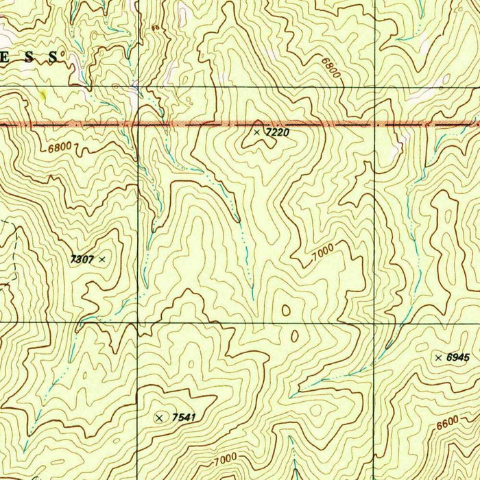
Published in 2002 from 1996 mapping, “Mica Mountain Quadrangle” is a finely detailed U.S. Geological Survey topographic portrait of one of southern Arizona’s most evocative desert landscapes. Centered on the Rincon Mountain District of Saguaro National Park, the map captures a dramatic meeting of Sonoran Desert lowlands and rugged mountain terrain. At 1:24,000 scale, it records the land with the precision for which USGS quadrangles are prized: contour lines, drainage patterns, trails, roads, vegetation, and named natural features are all arranged with sober clarity. The result is both practical and atmospheric, revealing how Mica Mountain rises above cactus-studded basins, arroyos, ranchlands, and wilderness corridors near Tucson.
The U.S. Geological Survey brought more than a century of federal cartographic discipline to maps such as this. Founded in 1879, the USGS became the authoritative mapper of America’s physical landscape, producing quadrangles that served scientists, engineers, land managers, hikers, and communities alike. This map belongs to the mature late-twentieth-century USGS tradition, when standardized symbols, crisp typography, and carefully calculated contours created a visual language of remarkable reliability. Rather than embellishment, its beauty lies in exactitude: the spacing of elevation lines, the hierarchy of streams and roads, and the quiet balance between human settlement and wild terrain. It is a scientific document, yet it also reads as a tribute to the landforms it describes.
Saguaro National Park dominates the map’s identity, especially the Rincon Mountain District, a protected landscape famous for the towering saguaro cactus, an enduring emblem of the American Southwest. The Cactus Forest area, the park visitor facilities, and nearby routes into the foothills indicate a region where conservation, recreation, and ecological study intersect. The map also places the park within its broader setting: Tucson lies nearby, while Tucson Mountain Park and the Santa Cruz River form part of the larger metropolitan and desert geography. These relationships are historically important, showing the park not as an isolated preserve but as a protected refuge shaped by expanding urban edges, desert waterways, ranching traditions, and public access.
The topographic character of the quadrangle is especially compelling. Mica Mountain and the surrounding Rincon Mountains are rendered through dense, expressive contouring, rising from desert flats into cooler uplands and forested elevations. Wild Horse Canyon, Tanque Verde Creek, and other washes and drainages trace the passage of seasonal water through an arid environment where every channel matters. The Agua Caliente Wilderness and the vicinity of Tanque Verde Ranch add further layers of terrain and human history, suggesting trails, canyons, springs, and historic routes into the mountains. To the south and west, references to Vail, the Santa Rita Mountains, and the Santa Cruz River broaden the map’s sense of regional continuity.
As a historical record, this quadrangle captures Saguaro National Park and its surroundings at a revealing moment near the turn of the twenty-first century. The 1996 survey data preserves patterns of roads, park boundaries, land use, and natural features during a period when southern Arizona faced increasing development pressure and growing awareness of desert ecology. USGS maps like this are invaluable for comparing landscape change over time: shifting trails, altered washes, expanding communities, wildfire impacts, habitat stress, and the long-term effects of climate variability can all be studied against their carefully measured framework. Elegant in its restraint and rich in geographic intelligence, “Mica Mountain Quadrangle” is a precise window onto the desert mountains east of Tucson.
Cities, towns and places on this map
- Saguaro National Park
- Mica Mountain
- Tucson Mountain Park
- Rincon Mountain District
- Cactus Forest
- Tanque Verde Creek
- Desert
- Wild Horse Canyon
- Agua Caliente Wilderness
- Vail
- Santa Rita Mountains
- Santa Cruz River
- Saguaro National Park Visitor Center
- Tucson (proximity noted)
- Tanque Verde Ranch
Historical context & cartographic details
- Produced by the U.S. Geological Survey (USGS).
- Historical 1:24,000 topographical map of Saguaro National Park in Arizona and the surrounding area.
- Dated 1996, with a 2002 imprint.
- Uses a conventional USGS topographic style, with contour lines to show elevation and shading to indicate terrain features.
- Emphasizes clarity and accuracy, consistent with USGS publications from the period.
- Shows elevations, slopes, mountains, valleys, vegetation types, and other landforms characteristic of southern Arizona’s arid desert environment.
- Documents landscape conditions over time, including development pressure, climate change impacts, and land-use shifts affecting Saguaro National Park and nearby areas.
- Useful for hiking, topographic interpretation, and ecological study.
Looking for a particular place? Review the detailed images to confirm that the town, landmark or feature you have in mind appears on the map. If you are unsure, ask our workshop to check before you order.
Detailed maps are especially rewarding at larger sizes, where names, boundaries and decorative features have more room to be appreciated. Use the close-up preview and size guide to choose the right scale for your wall.
This map looks amazing at sizes all the way up to 50in (125cm). If you are looking for a larger map, please get in touch.
The model in the listing images is holding the 16x20in (40x50cm) version of this map.
Where personalisation is available, you can add a short title or dedication, mark one meaningful place, or request one considered visual detail. See personalised map examples.
Every piece is printed to museum-grade archival standards using fade-resistant pigment inks on acid-free matte paper. Choose an unframed map print, framed map or canvas using the finish options above. Framed maps use crystal-clear optical acrylic and arrive ready to hang.
With its rich detail and strong sense of place, this map makes a considered gift for a new home, anniversary, retirement or anyone with a personal connection to the area shown. Still deciding? Explore our collection of rare old and vintage maps to discover another place, period or style.
Share