The Unique Maps Co.
Map of Magnolia Springs, Alabama by USGS, 1980 – Weeks Bay & Bon Secour Bay
Map of Magnolia Springs, Alabama by USGS, 1980 – Weeks Bay & Bon Secour Bay
Não foi possível carregar a disponibilidade de retirada.
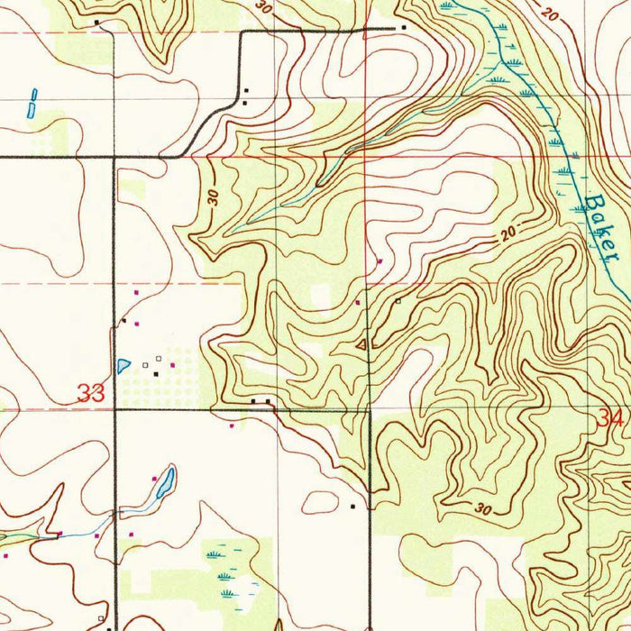
Published in 1986 from mapping dated 1980, the US Geological Survey’s “Magnolia Springs Topographic Map” presents a finely observed portrait of a distinctive corner of Baldwin County, Alabama. At a scale of 1:24,000, it captures the village of Magnolia Springs and the surrounding landscape with the precision that made USGS quadrangles indispensable to planners, scientists, engineers, and travelers. The map’s conventional topographic language—contour lines, hydrographic tints, road classifications, woodland symbols, and built structures—creates an elegant visual record of terrain and settlement. More than a technical document, it preserves a moment in the late twentieth-century Gulf Coast hinterland, before subsequent decades of population growth and changing land use reshaped portions of the region.
Magnolia Springs itself is the emotional center of the map, a community long associated with its clear natural spring, shaded roads, and waterside setting. The town lies within a landscape where freshwater systems, wooded tracts, and gently undulating ground meet the broader estuarine world of coastal Alabama. The map’s attention to streams, lowlands, and drainage patterns reveals how intimately local life is tied to water: settlement follows higher, drier ground, while channels and wetlands structure movement through the surrounding countryside. Roads thread between forests and open areas, suggesting a rural environment still strongly defined by natural features. In this sense, the map is both geographic record and environmental portrait.
To the west and south, the presence of Weeks Bay and Bon Secour Bay situates Magnolia Springs within one of Alabama’s most ecologically significant coastal regions. These bays form part of a rich transition zone between inland waters and the Gulf of Mexico, supporting marshes, tidal creeks, fisheries, birdlife, and diverse plant communities. The USGS depiction of shorelines, waterways, and adjacent low-lying terrain gives the viewer a clear sense of the area’s delicate hydrology. Here, subtle elevation changes matter: a small rise in contour can mark the difference between habitable land, wooded upland, and seasonally wet ground. The result is a map that quietly communicates the ecological complexity of the Gulf Coast plain.
The US Geological Survey brought to this map nearly a century of institutional expertise in scientific cartography. Founded in 1879, the USGS became the United States’ principal authority for systematic topographic mapping, geological investigation, and natural resource assessment. Its quadrangle maps are celebrated for their disciplined symbology and dependable field-based information, and this Magnolia Springs sheet reflects that tradition. The contour lines are not decorative flourishes but measured statements of relief; the blue water features, black cultural markings, green wooded areas, and brown elevation data together form a layered language of place. For collectors, this cartographic style has a restrained beauty: factual, lucid, and quietly authoritative.
Historically, the map records Magnolia Springs and its environs at an important threshold. By 1980, Baldwin County was still far less developed than it would become in the following decades, yet the pressures of coastal growth, improved roads, tourism, and residential expansion were already part of the region’s future. The roads, buildings, forests, and waterways shown here offer a benchmark against which later transformation can be understood. Its depiction of hilly and low-lying terrain, wooded areas, and bay-adjacent wetlands evokes a landscape balanced between rural continuity and impending change. As such, the map is not only a practical survey of southern Alabama topography, but a historical document of coastal settlement, ecology, and land use.
Cities, towns and places on this map
- Magnolia Springs
- Weeks Bay
- Bon Secour Bay
- Various contour lines indicating terrain elevation
- Roads and highways
- Water features, including streams, rivers, and lakes
- Surrounding forests and wooded areas
Historical context & cartographic details
- Name of the map: Magnolia Springs Topographic Map
- Date of creation: 1980; published in 1986
- Mapmaker/publisher: US Geological Survey, also known as USGS
- Scale and type: Historical 1:24,000 topographical map
- Mapmaker context: The US Geological Survey is an established scientific agency of the U.S. government, known for authoritative mapping, geological surveys, and natural resource assessments
- Cartographic style: Uses conventional topographic symbology, including detailed contour lines, water bodies, roads, buildings, distinctive colors, and map symbols
- Topographic character: Shows elevation changes and relief, reflecting a mix of hilly and low-lying terrain typical of Alabama’s landscape
- Historical significance: Provides a record of the area before later population growth, development, and land-use changes altered parts of the natural and cultural landscape
Looking for a particular place? Review the detailed images to confirm that the town, landmark or feature you have in mind appears on the map. If you are unsure, ask our workshop to check before you order.
Detailed maps are especially rewarding at larger sizes, where names, boundaries and decorative features have more room to be appreciated. Use the close-up preview and size guide to choose the right scale for your wall.
This map looks amazing at sizes all the way up to 50in (125cm). If you are looking for a larger map, please get in touch.
The model in the listing images is holding the 16x20in (40x50cm) version of this map.
Where personalisation is available, you can add a short title or dedication, mark one meaningful place, or request one considered visual detail. See personalised map examples.
Every piece is printed to museum-grade archival standards using fade-resistant pigment inks on acid-free matte paper. Choose an unframed map print, framed map or canvas using the finish options above. Framed maps use crystal-clear optical acrylic and arrive ready to hang.
With its rich detail and strong sense of place, this map makes a considered gift for a new home, anniversary, retirement or anyone with a personal connection to the area shown. Still deciding? Explore our collection of rare old and vintage maps to discover another place, period or style.
Share