The Unique Maps Co.
Map of Bass Lake, California by USGS, 1993 – Sierra National Forest & Madera County
Map of Bass Lake, California by USGS, 1993 – Sierra National Forest & Madera County
Não foi possível carregar a disponibilidade de retirada.
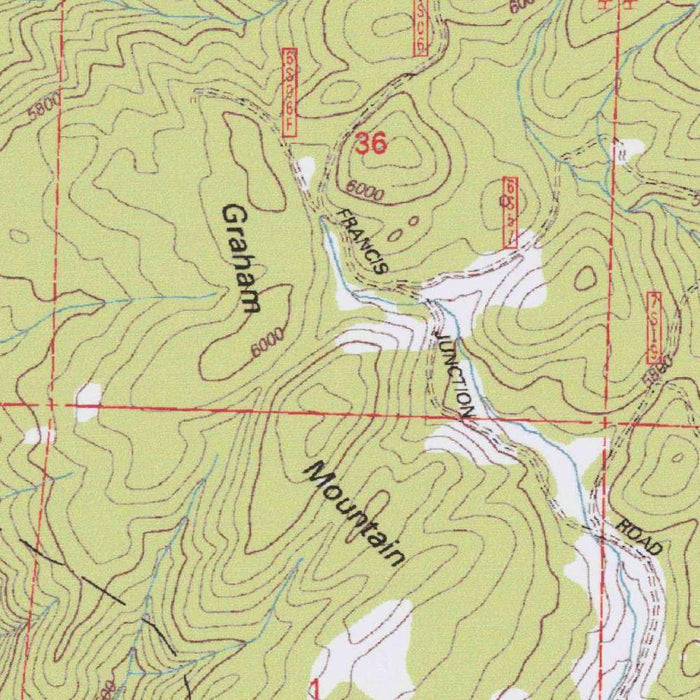
Titled “Bass Lake,” this United States Geological Survey topographic map was published in 2002 using survey data from 1993, preserving a precise late-twentieth-century portrait of one of California’s most beloved Sierra Nevada landscapes. Drawn at the classic 1:24,000 scale, it presents the lake and its surrounding country with the clarity and authority for which USGS quadrangles are renowned. Bass Lake itself forms the visual and geographic center of the composition, its shoreline set amid a rugged matrix of forested slopes, roadways, trails, elevation marks, and drainage features. The result is both a navigational document and a historical record of how this mountain recreation area was understood, measured, and mapped at the close of the twentieth century.
Bass Lake has long been valued as a gateway to the Sierra Nevada, combining the character of a mountain reservoir with the atmosphere of a forest retreat. On the map, the lake appears not as an isolated destination, but as part of a broader terrain shaped by ridges, valleys, roads, and public lands. The surrounding Sierra National Forest gives the sheet much of its character, with road segments and trail networks threading through wooded elevations and remote contours. These details evoke a landscape used for recreation, forestry, access, and conservation, where human movement is carefully fitted into mountainous terrain. Nearby lakes, reservoirs, hills, valleys, and peaks complete the impression of a varied and deeply textured highland environment.
The cartographic language of the map is especially compelling: a disciplined system of contour lines, color, symbols, and labels that translates the Sierra foothills into an elegant visual code. Elevation changes are expressed through tightly and broadly spaced contours, allowing the eye to read slopes, draws, ridgelines, and basins with remarkable immediacy. Roads and trails are differentiated from natural drainage and forest features, while spot elevations and benchmark-style markings give the terrain a measured precision. This is the USGS topographic style at its mature modern stage—scientific, restrained, and highly legible. For a collector, the appeal lies in this union of utility and beauty: the map is factual, but its patterns of water, forest, and relief are quietly artistic.
As a document based on 1993 survey information, the map captures Bass Lake and its surroundings at a meaningful moment in the region’s modern history. The late twentieth century brought increasing attention to land management, wildfire risk, recreation infrastructure, water resources, and environmental protection in California’s mountain forests. A topographic map such as this offers evidence of roads, trails, developed access points, and the distribution of named and unnamed natural features at that time. It can be read as a baseline for observing later change: shifts in development, forest use, conservation priorities, and the evolving relationship between visitors and the Sierra landscape. Its value lies not only in what it shows, but in the moment it preserves.
The United States Geological Survey, founded in 1879, occupies a singular place in the mapping history of the United States. Its topographic quadrangles became the standard reference for engineers, hikers, planners, scientists, land managers, and anyone seeking a rigorous understanding of the American landscape. In “Bass Lake,” that institutional legacy is visible in every contour, symbol, and carefully placed name. The map transforms a familiar California destination into a measured geography of elevation, access, water, and forest. It invites close reading: the shoreline of the lake, the rise of surrounding hills, the routes into the Sierra National Forest, and the subtle organization of a mountainous watershed. It is a refined cartographic portrait of place, purpose, and terrain.
Cities, towns and places on this map
- Bass Lake
- Sierra National Forest
- Road segments and trails through the national forest
- Nearby lakes and reservoirs
- Specific topographical landmarks, such as hills, valleys, and peaks
Historical context & cartographic details
- Produced by the US Geological Survey, this historical 1:24,000 topographical map illustrates Bass Lake in California and the surrounding area.
- The map uses survey data from 1993 and carries a 2002 imprint.
- Published by the US Geological Survey (USGS), a scientific agency of the U.S. federal government known for reliable geographic data and topographic maps.
- The map includes detailed topographical contours, using colors and symbols to indicate elevation changes and natural features.
- It displays varied mountainous terrain, with contour lines illustrating elevations, slopes, valleys, and related landforms.
- The map provides insight into the geographical and ecological characteristics of the Bass Lake area as of 1993.
- It is useful for tracking changes in land development, conservation efforts, and natural resource use over time.
- The map reflects cartographic practices of its period, including color gradients for elevation and detailed representation of natural features to support orientation and navigation.
Looking for a particular place? Review the detailed images to confirm that the town, landmark or feature you have in mind appears on the map. If you are unsure, ask our workshop to check before you order.
Detailed maps are especially rewarding at larger sizes, where names, boundaries and decorative features have more room to be appreciated. Use the close-up preview and size guide to choose the right scale for your wall.
This map looks amazing at sizes all the way up to 50in (125cm). If you are looking for a larger map, please get in touch.
The model in the listing images is holding the 16x20in (40x50cm) version of this map.
Where personalisation is available, you can add a short title or dedication, mark one meaningful place, or request one considered visual detail. See personalised map examples.
Every piece is printed to museum-grade archival standards using fade-resistant pigment inks on acid-free matte paper. Choose an unframed map print, framed map or canvas using the finish options above. Framed maps use crystal-clear optical acrylic and arrive ready to hang.
With its rich detail and strong sense of place, this map makes a considered gift for a new home, anniversary, retirement or anyone with a personal connection to the area shown. Still deciding? Explore our collection of rare old and vintage maps to discover another place, period or style.
Share